Day 13: 21 August 2013: Part 2: Batal to Chandratal – Full Moon Day at Chandratal

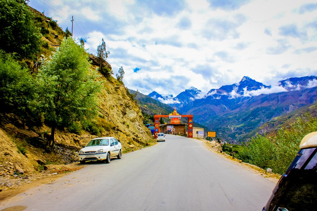
After spending some 40-45 minutes with Batal Chacha, having our fill of Maggi and Tea, we proceed towards Chandratal. To reach Chandratal, you need to go towards Kunzum from Batal, cross the bridge on Chandra river and then from the tri-junction, you need to take the left fork going at the same level of elevation. The right one going upwards goes towards Kunzum Jot and then Kaza. But we have to go to Chandratal first, today being the full moon day and hence we take the left fork towards Chandratal.

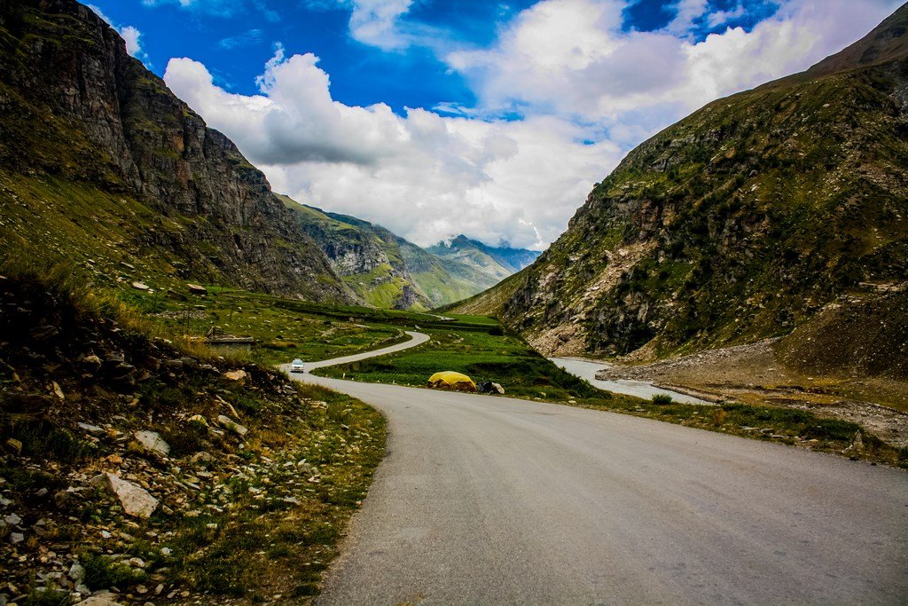
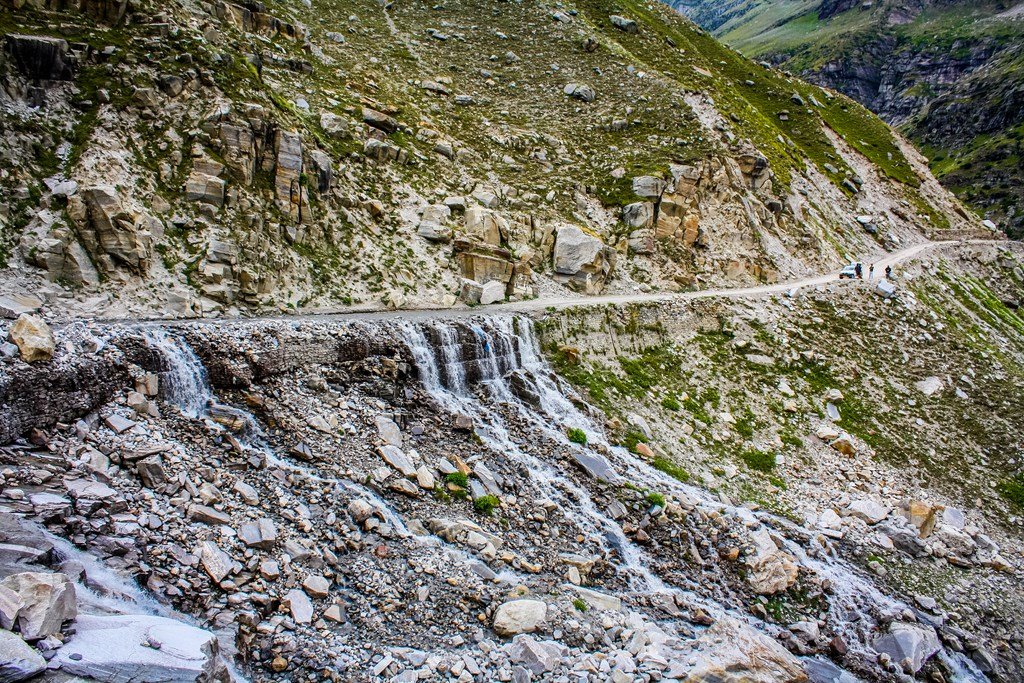
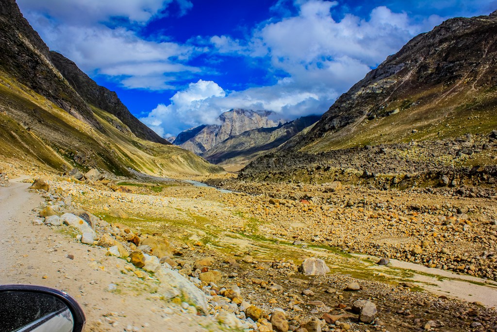
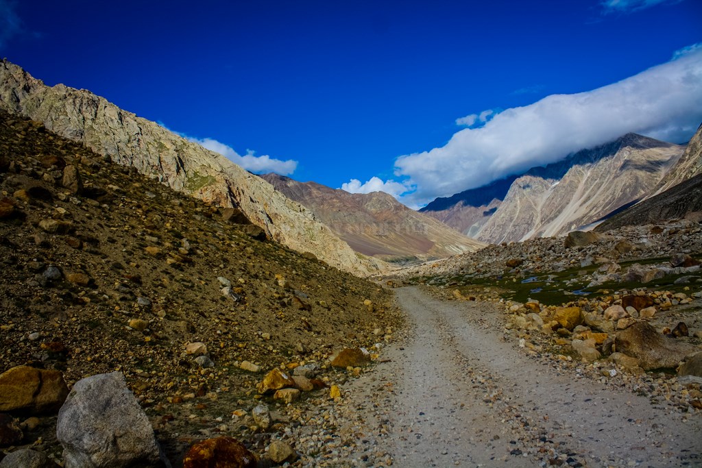
A board at the tri-junction notifies the “Jeepable road” road towards Chandratal…

jeepable road!


And this is what is called “Jeepable”…

13.79


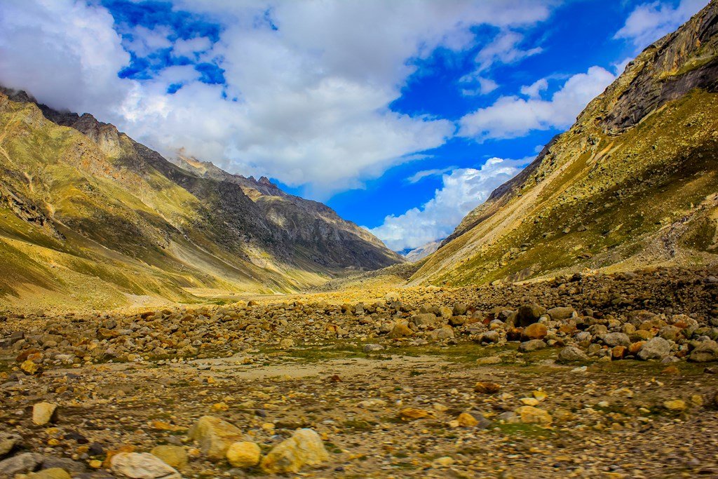
But the views are amazing and we have the Cheetah, so who’s complaining?
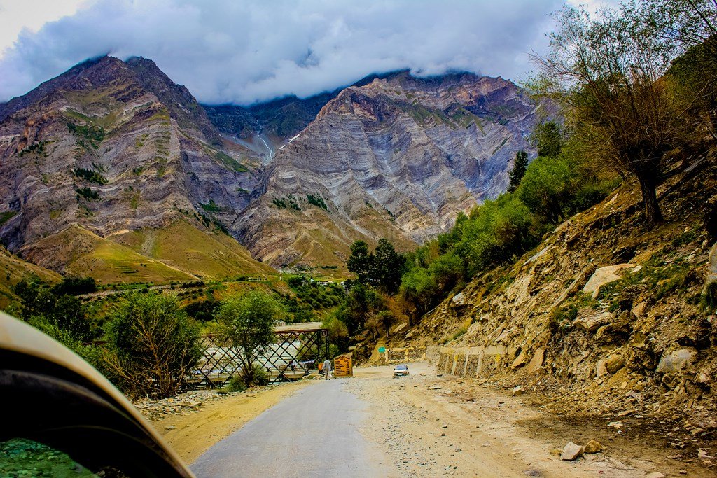
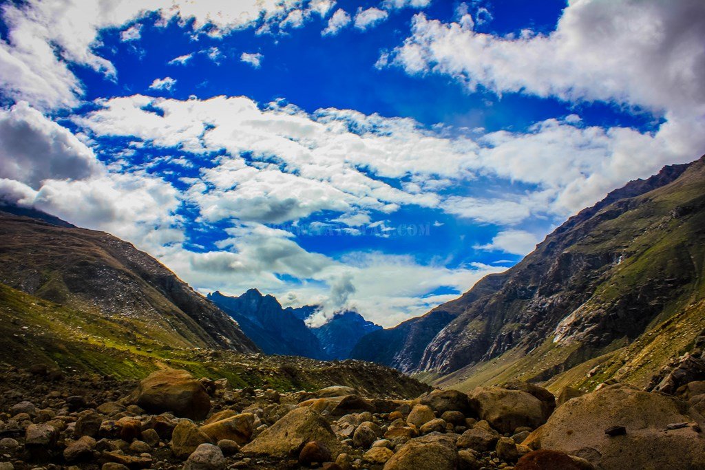
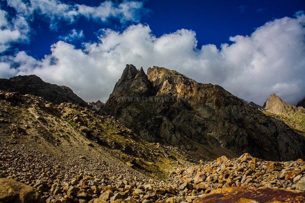
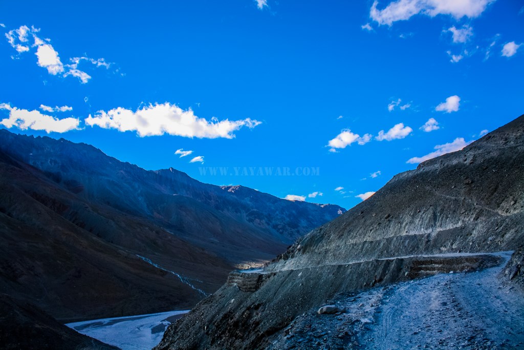
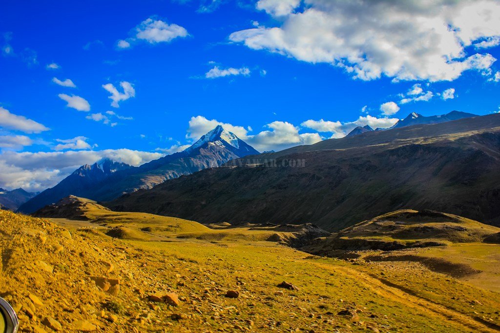
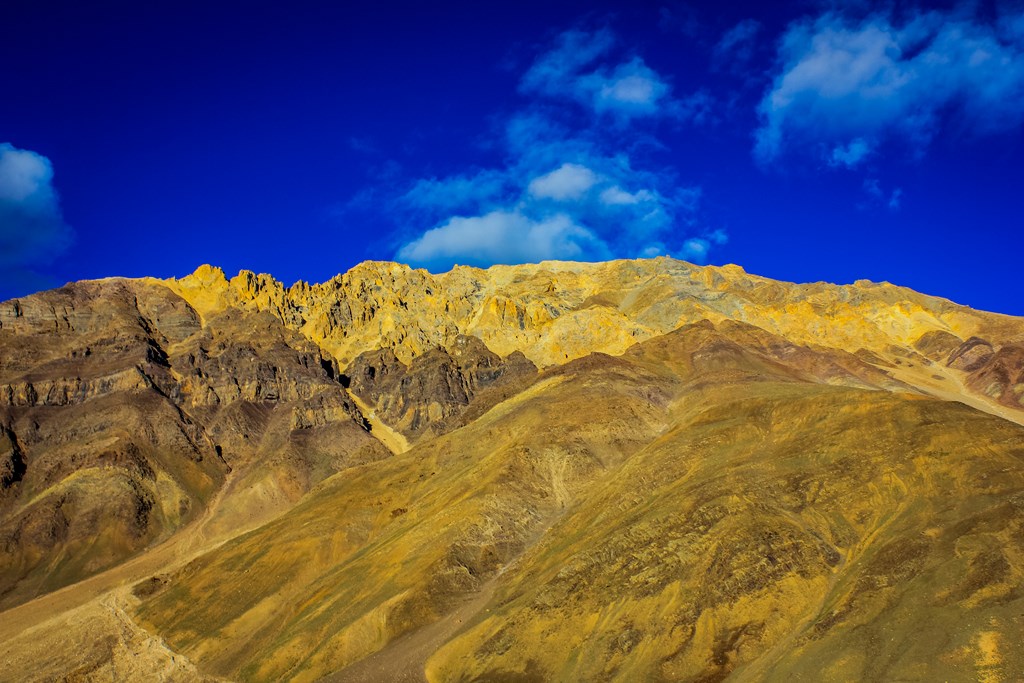
The Moulkila ranges

The Moulkila ranges

13.81

The snow-clad Chandrabhaga (CB) ranges

The snow-clad Chandrabhaga (CB) ranges


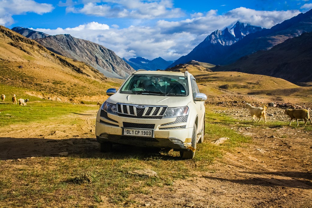
Pretty soon, we came to sight some camps and a heard of goats and sheep. Have we arrived?

13.83


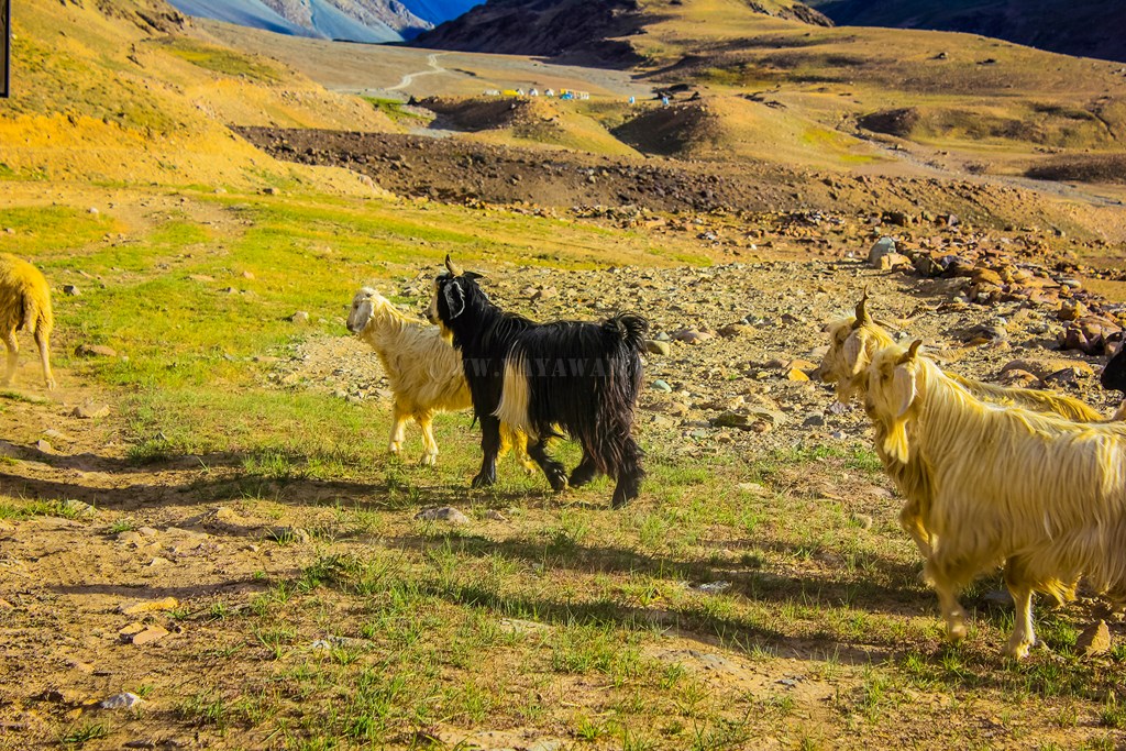
Excited, we get down the car. I however, do not see the trademark of Jamaica’s camp – an indigenous mannequin wearing a T-shirt! So we ask the Gaddi who is the owner of the herd for the whereabouts of Jamaica’s camp.

13.84
13.85


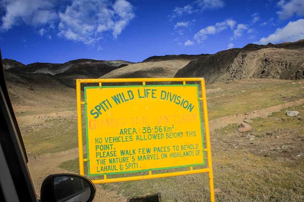
Apparently, Jamaica’s camp is located nearest to the Chandratal lake, further ahead of the point which announces that no vehicles are allowed further…

13.86


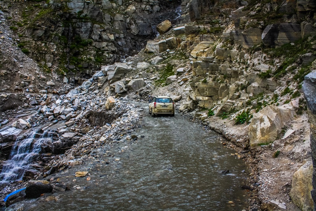
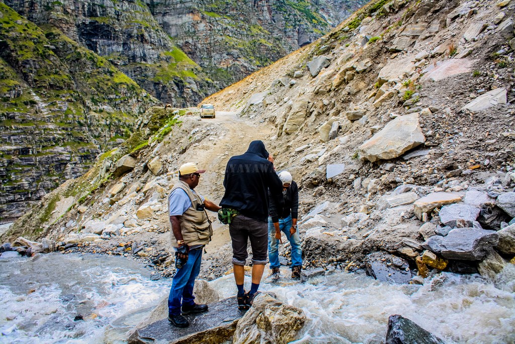
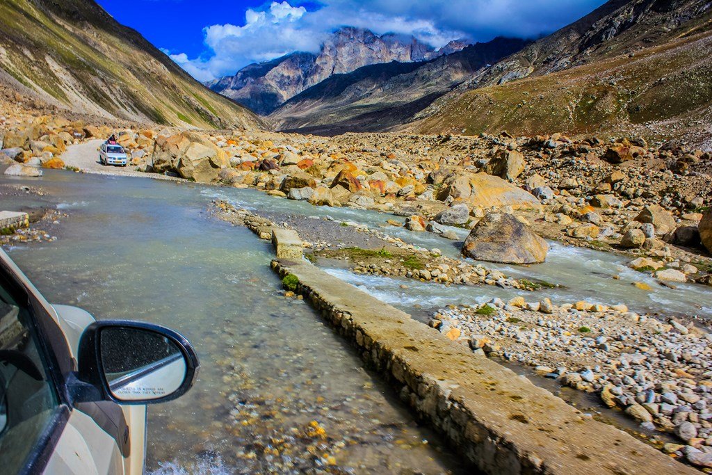
We drive ahead and start gaining height. Just ahead, there’s a vehicle coming from another direction and there is barely space to give a pass. Cheena drives the car dangerously close to the right edge which is at about 8-10 feet of height from the ground level. We all shout at him not to cut any further, but by that time he has already managed to slip the rear right tyre off the road! We all get down immediately, for the height is at least enough to topple the Cheetah and cause a tumble. The driver of the Bolero coming from opposite side also comes to our help and together we start pushing the vehicle with Cheena driving so that we can put it back on the road. I’m pushing it from just behind the rear right wheel and as it spins, I’m bathed with dust all over, but ultimately we are successful to put the Cheetah back on the track. Never mind, we’re going to Chandratal and everything will be clean soon.

13.87


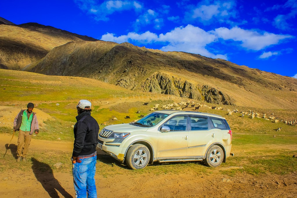
So we hop on and drive again clicking pics.. we reach a place where there is a wall on the road and couple of vehicles are already parked.

13.88


One of the car (mostly Boleros run here) seems to have some drivers sitting and enjoying music. I didn’t noticed the indigenous mannequin as it was hidden behind the car and so I ask the person sitting near the window where can I find Jamaica. The person wearing a red sweatshirt gets down the car immediately, puts on his cap, stands in a salute position, and says “Main hi hai sir Jamaica”. Now I’ve had a couple of PMs exchanged with Jamaica on BCMT Forum and had intimated him of my plans of coming today. I remind him and he remembers. I’m impressed as he’s very very friendly. I ask him about the accommodation as we want to pitch our own tents and he gladly agrees. We take out our tents, however, the 3-person tent that Tony was carrying, is drenched in diesel. This must have happened when the diesel spilled during our drive from Spangmik to Chusul and then Chusul to Tangtse via Erath. This one is not usable now. However, my Quechua T2 tent is perfectly fine. So Jamaica asks his people to spread the 3-person tent so that it is dried up and the diesel smell goes away. He says that the boys will erect the other tent, but first, we must have tea.

13.89


So we have our tea and then we decide to pay a visit to Chandratal before it gets dark. Jamaica shows us the trail and says that by the time we’re back, he’ll get our tent erected and arrange for another tent too. So we hit the trail…

13.90


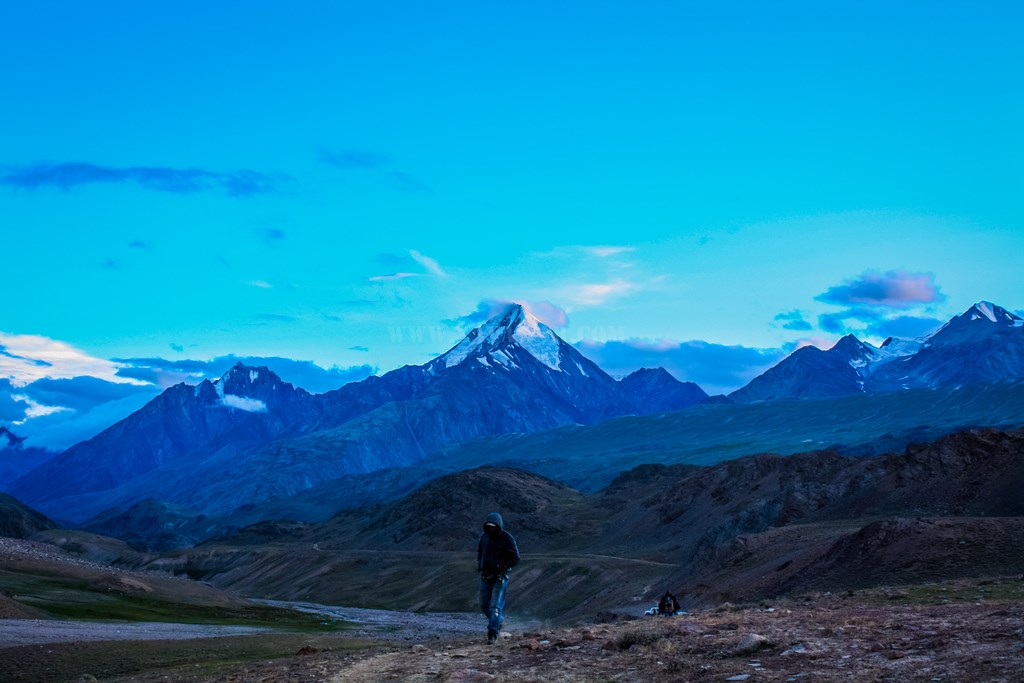
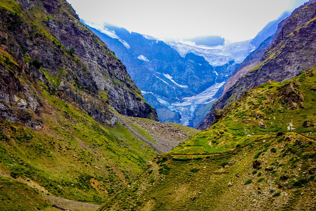
The peaks in CB range are full of snow/ice and with the scattered light, they make a nice backdrop…

13.91
13.92

Me and Avi in the backdrop of CB peaks

Me and Avi in the backdrop of CB peaks


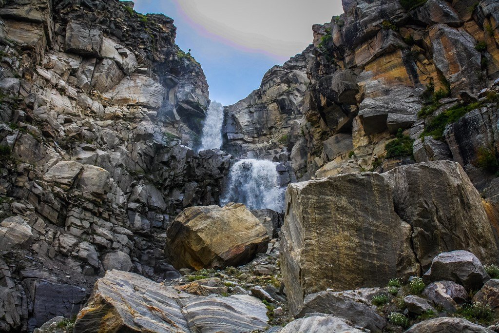
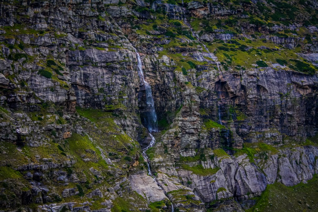
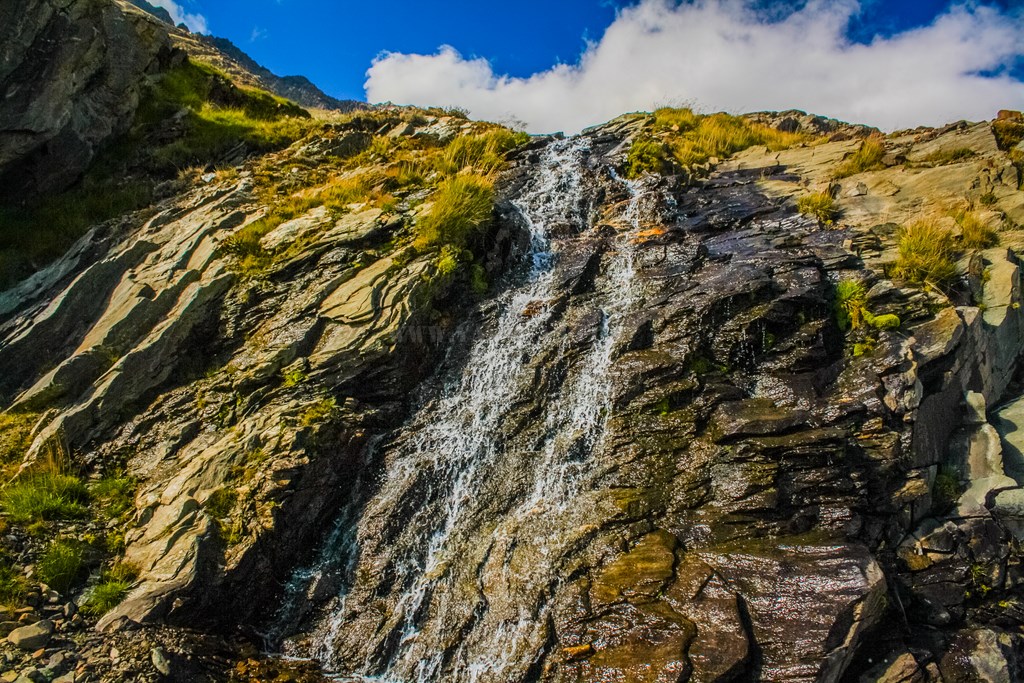
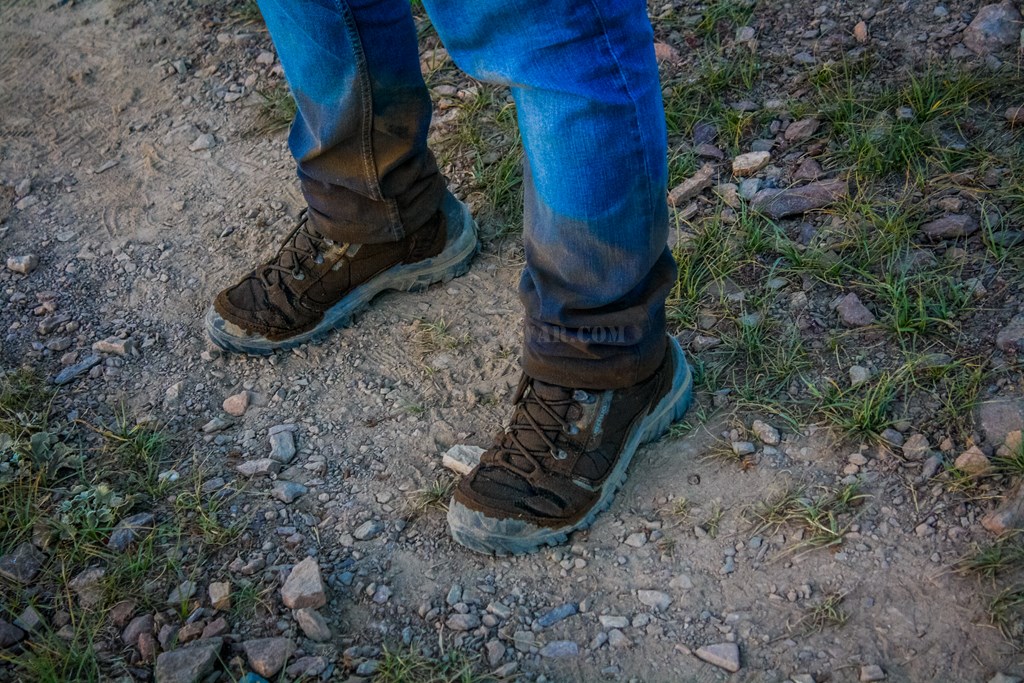
It’s a dusty trail, evident from the dirt stuck to the wet shoes… the shoes haven’t dried since we crossed the mighty waterfall…

13.94
13.95


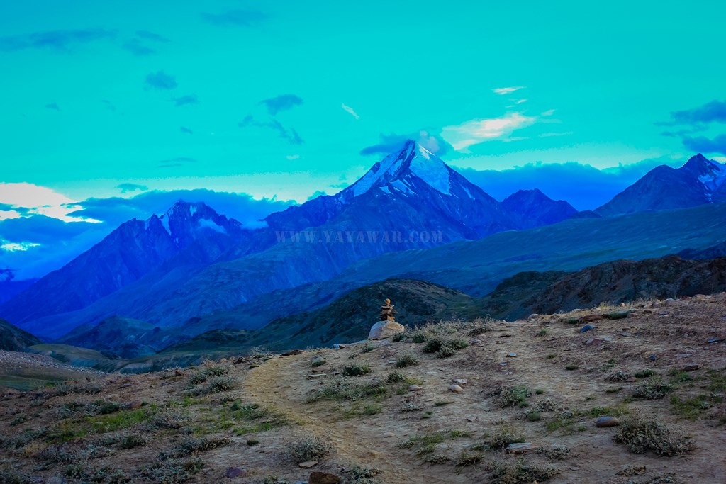
And then as we’re about to cross a hill, we see the first view of Chandratal… The time reads 1900 hrs

First view of Chandratal

First view of Chandratal

13.97


There is a stream coming out of the Chandratal and since my Quechua Forclaz 500 shoes are already wet and dirty, I walk into it… after all the shoes are waterproof, but already drenched! πŸ™‚

13.98
13.99


Some horses are grazing at the banks of Chandratal

13.100
13.101


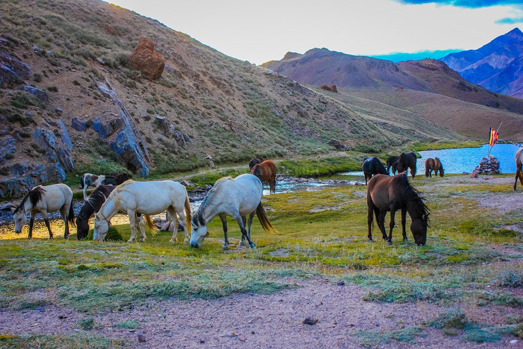
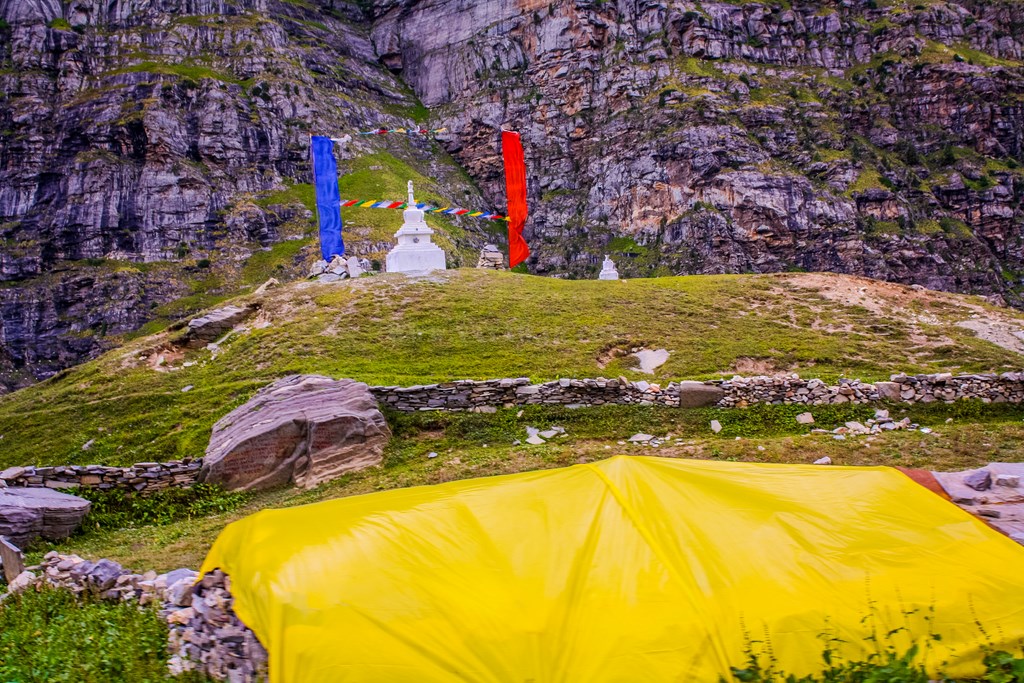
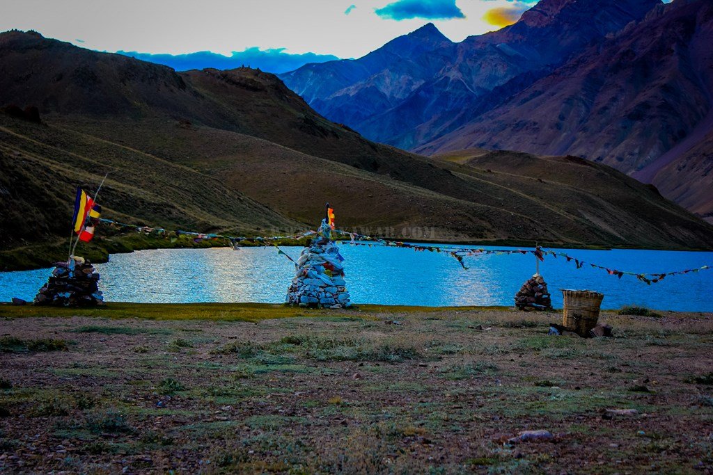
There are chortens alongside the Chandratal shore and so as a basket to drop the waste.. good thought!

13.102


A board announces that this Chandratal catchment area is part of Ramsar Wetlands and gives a list of wildlife that can be found here.. though we didn’t see anything except for the horses.

13.103


The evening golden rays on the clouds are creating magic on the Chandratal…

13.104


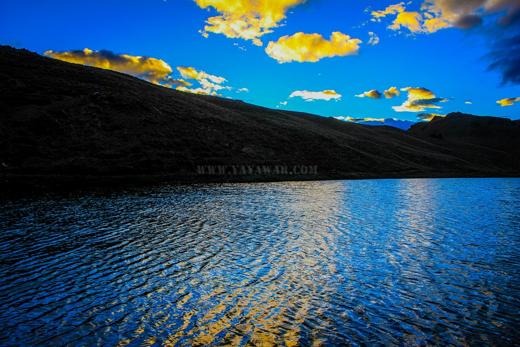
The water is green and very clear…

13.105


Chandratal is said to be crescent in shape and we notice it turning beyond the hills…

13.106


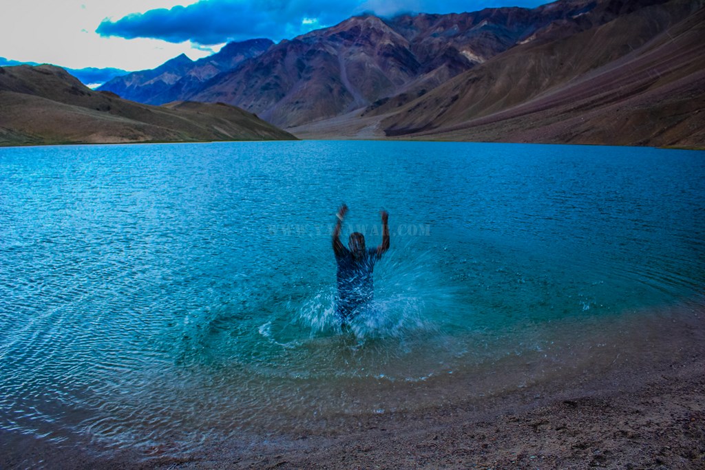
We will explore this in detail tomorrow, but first I need to touch the water of Chandratal..

13.107


And click one of the CB peaks, peeking from behind a hill…

13.108


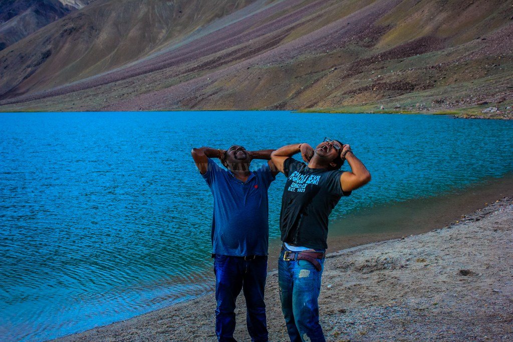
I go knee deep in water. It is freezing cold and taking all tiredness away. I ask Cheena to come over and enjoy the waters and so he joins me…

13.109


Ecstatic on fulfilling a dream to visit Chandratal, I just fall backwards in the water, holding Cheena along. πŸ™‚ I get fully wet, that’s what I wanted! Cheena gets half wet and is feeling too cold and so jumps out!

13.110


… And we pose…

13.111


Not satisfied with the dip, I ask everyone to join and that we take some dips in the ice cold water. We are not carrying any spare cloths and so Cheena, Avi and Tony stay away, while I go back to take 3 dips and make some splash…

13.112


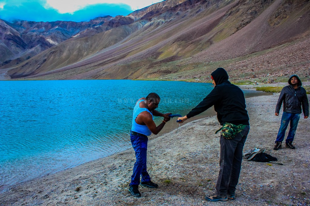
Having no spare clothes, I wring out the tee and vest and wear them again, meanwhile Cheena has packed himself in the jacket πŸ˜›

13.113


One last pic of the Chandratal with snow-clad peaks as the backdrop and then we trek back to the camp.
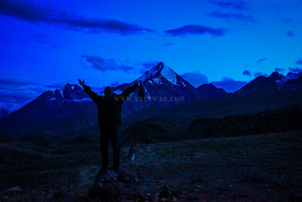
13.114

Ecstatic with Joy!

Ecstatic with Joy!

Camps at distance

Camps at distance


We come back and spread our cloths at nearby rocks to dry. As promised, Jamaica has got our tents erected and arranged for another tent too. There doesn’t appear to be too many tourists today even being the full moon day! While Cheena changes dress, I go to meet Jamaica again and inquire about the dinner. There we meet the forest guard – a poor fellow from Spiti who has been working on contract for 6 years and still the government is not taking him on permanent rolls. During the season, he does his duty at Chandratal and during winters, he’s without a job, working as a laborer in Kaza. To top that, the Forest Department has not even provided him any tent or dueling near Chandratal. It is Jamaica who has erected a Gaddi dueling for him and provides food to him. We also meet Batal Chacha’s son – Dawa Tashi in the kitchen tent and he’s cook for the night. Jamaica has various stories to tell about the place ranging from Goddess emerging from the Chandratal to Snow leopard to wolves and what not, so the time quickly crossed past 2030

13.117

Dawa Tashi – Batal Chacha’s son

Bakar in the kitchen tent :)

Bakar in the kitchen tent πŸ™‚


We keep on talking and we apprise Jamaica about our plan to go to Kaza tomorrow and then towards Delhi via Kaza-Nako-Chail-Shimla. Then Jamaica informs us that there has been a major landslide at Maling nullah and the route is closed since a week and it doesn’t appears that it would open for further a week, so taking that route is not possible. Then we decide to take the Manali route back to Delhi, however, as we would have planned to reach Delhi by 24th, we have enough time. Jamaica suggests that we should check Samudri Tapu tomorrow which is the source of Chandra River and no tourist has ever gone there yet. Only Gaddis go there over a rope crossing the Chandra River. We all agree to it.

While as per our plan, it was a full moon night and we had plans for night photography, once we had our dinner and “Spiti ka Paani”, we just went to our tents and retired.. sleeping sound.. not to wake up at night at all. The time reads 2330 hrs…


Next: Samudri Tapu

CONTD…

Total Distance covered: Approx 14 kms

Driving Directions from Batal to Chandratal: From Chandra Dhaba, start towards Kaza and cross the bridge on Chandra river and then from the tri-junction, take the left fork going at the same level of elevation. The right one going upwards goes towards Kunzum Jot and then Kaza. Keep on driving the track with river Chandra on the left for next 12.5 kms and park your vehicle before the board announcing the same. For next 1.5 kms, travel on foot following the tracks and you reach Chandratal.

Google Map directions for Batal to Chandratal travel: http://goo.gl/maps/fvsiV

Day 13: 21 August 2013: Part 1: Keylong to Batal

We woke up late knowing very well that we have to travel less today. Finished with the daily rituals, we realize that today was Rakshabandhan, and all of us had carried Rakhis from our sisters. We make a couple of phone calls to home as now the next network availability would be at Kaza, we help each other tie the Rakhis on the wrists and then we go for the breakfast.

Bhatia saab had given us option yesterday that if we want to leave early, he can get the breakfast packed too as it was complimentary with the rooms. We have ample time today and not rushing, hence we’ll have the breakfast at the Hotel Chandrabhaga itself.

13.1


Having done the breakfast, we loiter around a bit. We talk about cleaning the car, but then decide against it – the car should look like it has been on a long trip to Ladakh and Spiti! πŸ™‚ So we write YAYAWARS on the thick layer of dust accumulated

13.2


Finally, we hit the road around 1140 hrs.

Coming out of Keylong town..

13.3


Pristine rivulets and beautiful vistas are giving us company, and so is River Bhaga..

13.4
13.5


Soon we approach Tandi bridge…

13.6


… and witness the confluence of Chandra and Bhaga rivers, henceforth known as Chandrabhaga.

13.7


Now we would be driving along Chandra river till we reach Chandratal (almost). Multicoloured mountain on the way…

13.8


We see multiple rivulets merging in the Chandra river

13.9
13.10


Beautiful hamlets situated amongst the green mountains, towering peaks, ice capped peaks, glaciers, and glaciers giving rise to waterfalls… we see them all…

13.11
13.12

Can you notice a chorten in a cave?

Can you notice a chorten in a cave?

13.14
13.15
13.16


Soon we approach Sissu…

13.17

Sissu Lake

Sissu Lake

13.19


The roads are fully metaled and drive is a pleasure with outstanding landscape…

13.20


Glaciers are melting and to see that, you don’t need to zoom, it’s evident on the road itself!

13.21
13.22


Suddenly, the valley opens a bit and we can see Chandra river giving us company, with many streams merging into it. The fields have peas growing..

13.23
13.24
13.25
13.26


Lost in the nature, soon we reach Koksar and cross the bridge…

13.27


One beautiful about this part of Himachal (or shall I say Lahaul & Spiti) is that every 100 meters, you see a water fall or a stream coming down the montains and at times flowing on the road…

13.28
13.29


The roads have gone worse, the metal has vanished and it’s all slush and muck, the reason of course are the streams coming on the road. And we are quickly gaining altitude.. Gramphu / Gramphoo is near it seems…

13.30
13.31


Indeed it is Gramphoo

13.32


At Gramphoo, we take the left fork going towards Kaza. Very soon, we see that the streams have ably taken down the road. BRO, however, is on the job and they make a way quickly…

13.33


Multiple small streams are flowing on the road and we are enjoying making splash, at times driving carefully…

13.34
13.35
13.36
13.37


However, there is a majestic waterfall ahead which is result of glacial melt. We can see that clearly. A Maruti Alto is standing with couple of people walking around…

13.38


We drive nearer and notice that this is not so simple water crossing.. the water is flowing with all its might for around 150 meters of the road (or shall I call it a track), which appears damaged. Some horses are also there near the waterfall. One person is coming back after taking stock of the situation. I ask him if it is manageable. He says “You’ll have to try.. at least you have bigger wheel base..”

Can you see the horses?

Can you see the horses?


I decide to take stock of the situation myself and so I get down and walk ahead in the water. The current of water is good, but not enough to sweep away the Cheetah..

13.40


More than the fear of being swept away, it is the underbelly hits that I’m worried about. One mis-adventure and we’ll be stuck. So I keenly observe the placement of stones on the track and wave Cheena to drive and follow my directions.

13.41


With a little bit of difficulty, we manage to pass with one underbelly hit. After parking the Cheetah, we all come back to enjoy the waterfall and then we notice its majesty…

13.42
13.43
13.44


Taking a look back, we get better idea of the devastating effect it can have. The guys in Alto are still waiting, probably they’d turn back…

13.45


We drive ahead and pass by some chortens…

13.46


And the waterfalls at every 100 meters (at times even at lesser distance) continue…

13.47


Gradually, we lose altitude and the valley also opens up. We would now be driving almost at the level of river…

13.48


The road has vanished. At times, we are driving on just tracks over pebbles, similar to the Merak to Chusul drive

13.49


We cross Chandra River over a bridge and reach Chhatru.

13.51

Oh Yes! Now that we are in Himachal Pradesh, the “La” of Ladakh have been replaced by “Jot”

13.50


We do not stop here as the time is just 1520 and since we are in valley, we are a bit conscious about losing the daylight. So we drive ahead, cross many rivulets through bridges, meet many horses…

13.52
13.53


Road conditions notwithstanding, the vistas are beautiful.. very similar to that of Ladakh.. similar various coloured mountains, snow-clad peaks, just that these are a bit green and as in Ladakh, a river is giving us company…

13.54
13.55
13.56
13.57


At times, it feels like we are driving in the riverbed itself, with small pebbles underneath and big rocks all around..

13.58
13.59


Basking in the natural beauty and soaking it as much as we can, we reach Chhota Dara / Chhota Dhara

13.60
13.61


And then, we actually drive through the river bed..

13.62


Oh yes! Actually it is the river bed indeed!!

13.63
13.64


Gradually, the mountains are losing the greenery and becoming barren, much like Ladakh. Whoa! This is the reason Spiti is also called Mini-Ladakh!!

13.65
13.66


With occasional waterfalls and water crossings, the landscape continues, and so does the drive on the riverbed…

13.67
13.68


The Sun plays hide-n-seek with the clouds here too!

13.69


From a distance, we notice some small buildings / hutments. And finally we see the board for Chandra Dhaba. This is Batal. Although the time reads 1645, I have to meet Chacha.. have heard a lot about him and I can’t wait to meet him. So we stop here and start clicking pics. Little did we foresee the future that we would get more than ample time to do this…

13.70

The Dhaba

The Dhaba

13.73

A PWD Rest House has come up at Batal. Good for travelers!

13.72
For the record, this is the nearest dhaba from Chandratal where you can get accommodation and food. The Dhaba has also got a satellite phone which can be used to contact the world. All in all, oasis in desert.

13.74


We get inside and have maggi and tea as we hadn’t eaten anything since we left Keylong. While it is being prepared, I talk to Chacha and tell him that I’ve heard a lot of good things about him. Chacha is always smiling and points to couple of laminated certificates and newspapers that are hung on the wall. Oh My God!! Chacha and Chachi are Godfrey Philips Bravery Awardees!!! And the name is Dorje Bodh. This is why people call him by various names – Batal Chacha, Dorje Chacha, Dorje etc. We get ourselves clicked with him – it’s and honour to be in the same frame! And then we read the story of how the couple have saved over 106 people when they got stuck in snow. Great souls!!

Batal Chacha and Me

Batal Chacha and Me

13.76

The certificates

The certificates


Next: Batal to Chandratal

CONTD…

Total Distance covered: Approx 100 kms

Driving Directions from Keylong to Batal: From Hotel Chandrabhaga at Keylong, drive straight ahead towards Manali. Just ahead of the town, take the left fork at the tri-junction to remain on Manali highway. Drive straight ahead and do not take any cut to remain on the Manali highway and reach Tandi. Keep straight (an acute right turn goes towards Kishtwar and Sach pass) to cross the bridge over Chandra river and pass by Sissu further ahead. Couple of kilometers ahead at the tri-junction, take the left fork to go towards Koksar and Gramphoo. The right fork goes to the opening of Rohtang Tunnel which is likely to be completed sometime in future. Driving ahead, take the right fork at Koksar to remain on the highway and keep straight to reach Gramphoo. At gramphoo junction, keep straight (towards left) to go towards Kaza, the right fork goes to Rohtang and then Manali. Shortly after crossing the waterfall, there will be no road, just tracks. Keep following the tracks, cross as many bridges as they come and arrive at Batal as there is no other road between Gramphoo and Batal.

Google Map directions for Keylong to Batal travel: http://goo.gl/maps/SShIY